For this field outing, the main focus was to think about
crew resource management. The purpose for going out was to map a part of
McCormick woods using the Yuneec platform. We were positioned on the Ackerman-Allen
Golf course which butted up against the woods we were mapping. Approval was
needed and granted since we were a little less than two miles away from the
Purdue University Airport to ensure safe integration and coordination with
manned traffic. The Purdue University Department of Forestry and Natural
Resources needed to monitor the woods and our operation assisted them. In doing
this mapping mission, the gathered data should be able to analyze the treetop
structure and identify different species within the woods. This data was
collected using RGB imagery that was well suited for the mission.
The class was split up into three groups during this outing.
The first group was the flight control group and they were responsible for the
control of the aircraft as well as making initial radio calls and provided
mission organization. The other two groups were for visual observation and were
given a handheld radio to report when they had visual contact with the unmanned
aerial vehicle. Personally, I was involved with one of the visual observation
groups and our objective was to radio out when we had gained sight of the
unmanned aerial vehicle and to radio call again when we had lost sight of the
aircraft. This created a daisy chain that allowed this flight to remain
compliant Part 107’s visual line of sight rules. Not only did this assure that
we weren’t breaking the visual line of sight rule but it also allowed the
flight control group to have an understanding of the positioning of the
aircraft and any other traffic at all times. The mission was successful being
that we did everything in our power to ensure safety procedures were being met.
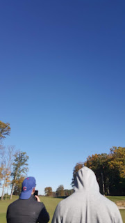
The image at the beginning of this post shows the Yunnec Platform. The two images at the bottom of this post display the view point of the furthest visual observation group. The image on the left side of the page displays the unmanned aerial vehicle over the section of McCormick Park that we were surveying with the Yuneec platform shown inside the red circle. The image on the right gives a look into the crucial communication element of this mission following Part 107 visual line of sight guidelines by maintaining radio contact with the flight control group. Kyle Sheehan is shown on the right side of the picture as well as myself making a radio call on the left side of the image.


No comments:
Post a Comment